Birgitta Trail // Birgitan polku
- Viivi Lampinen

- Jul 3, 2019
- 1 min read
Updated: Feb 7
Hello!
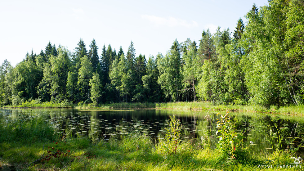
I was recently on a day hike on Birgitta Trail (Lempäälä, Finland). My route's starting point was Sääksjärvi (Tampere) and I walked through Ammejärvi and Siisjärvi to Hakkari (Lempäälä). The terrain was really variable: different types of forests, cut areas, stony paths, lakes, streams and a couple of small swamps. The length of my final route was about 15 kilometers. That distance took about 5 hours including breaks and taking pictures.
Birgitta Trail has been marked with yellow signs on trees so it's hard to get lost. I think the only negative thing was the number of mosquitoes. They won't be a problem unless you stay in a same place (taking photos for example) for a too long time. The whole trekking route is about 50 kilometers long and I walked only 15 kilometers of that length, so there is much more beautiful sights that I haven't seen yet.
Here is more information of the whole trekking route.